The latest about the Gap Fire:
About 90% contained; full containment expected by Tuesday the 22nd.
9,443 acres burned
4 outbuildings destroyed -- no homes destroyed!
Suppression costs so far: $20.4 Million
Cause: Human-caused; under investigation
Injuries: 12
There is still a small area that has an evacuation order, and other areas that are in "warning" mode.
There are plenty of "Thank you, Firefighters" signs around town. Thank goodness for them!
We had a power outage from about 8:00 last night till about 11:30 this morning. It wasn't fire related as far as we know; we heard the "boom" of a transformer. It was a weird outage: for most of the morning, it came and went, and when we had power, it was just a little bit.
Showing posts with label Gap Fire. Show all posts
Showing posts with label Gap Fire. Show all posts
Tuesday, July 15, 2008

Tuesday, July 8, 2008

Monday, July 7, 2008
Monday Gap Fire Update
7:30pm
More optimism today! They’ve lifted the Evacuation Warnings in the area just north of us, so I think I’ll unpack tonight. The fire is still not out yet, of course. But it is moving into unpopulated areas.
The weather was great today! We awoke to fog overhead, and though that doesn’t necessarily mean fog up in the foothills, it does mean an onshore flow and higher humidity. They've downgraded the air quality alerts. It is safe to breathe again!
Edison folks expect more power interruptions, and they are asking us to conserve electricity.
Here is a link to the latest map. It shows the perimeter as of last night.
Latest statistics:
Acres burned: 9,600
Percent contained: 35%
Expected containment: unknown
Injuries: 4 (two with smoke inhalation, one allergic bee sting and one heat exhaustion)
Structures threatened: 3,239
Structures destroyed: 4 Outbuildings
Suppression cost to date: $7.6 Million
Cause: Human cause; under investigation.
More optimism today! They’ve lifted the Evacuation Warnings in the area just north of us, so I think I’ll unpack tonight. The fire is still not out yet, of course. But it is moving into unpopulated areas.
The weather was great today! We awoke to fog overhead, and though that doesn’t necessarily mean fog up in the foothills, it does mean an onshore flow and higher humidity. They've downgraded the air quality alerts. It is safe to breathe again!
Edison folks expect more power interruptions, and they are asking us to conserve electricity.
Here is a link to the latest map. It shows the perimeter as of last night.

Latest statistics:
Acres burned: 9,600
Percent contained: 35%
Expected containment: unknown
Injuries: 4 (two with smoke inhalation, one allergic bee sting and one heat exhaustion)
Structures threatened: 3,239
Structures destroyed: 4 Outbuildings
Suppression cost to date: $7.6 Million
Cause: Human cause; under investigation.
Sunday, July 6, 2008
Sunday Gap Fire Update
4:00pm
Things are optimistic today!
A national team from Montana is taking over management.... ahem, I mean the Northern Rockies Type-I Incident Management Team.
There are about 2,500 firefighters active on this fire according to the new incident commander at today’s press conference. There are still a lot of helicopters and air tankers helping out.
The southern edge looking “extremely good” according to the incident commander, and it is in mop-up stages; the eastern boundary is also looking good. The northern boundary is West Camino Cielo road, and the fire isn't expected to leap over.
The western side still concerning. It is very rugged, and conditions are not very safe for firefighters. It is spreading west, but not really spreading in other directions.
Most areas that were evacuated revert to “Evacuation Warnings.” There are still mandatory evacuations mostly in the Western. There are no road closures in our area anymore--only in the extreme eastern and extreme western areas of the fire.
Weather is good. The sundowners are expected to be over. The weather is due to get very hot over the next few days.
We lost power for about an hour this afternoon. I had just gone out to do some errands. Home Depot was able to complete my transaction, but at Staples was doing cash-only sales, with an escort to get the items. I waited a little bit for an escort, but then decided I could wait to buy my dumb fax film.
Here are the latest Gap Fire statistics:
Acres burned: 9,367
Percent contained: 28%
Expected containment: unknown
Injuries: 2 (Smoke Inhalation)
Structures threatened: 1,700
Structures destroyed: 4 Outbuildings
Suppression cost to date: $6.2 Million
Do you remember this picture from Christmas, 2006? It was taken very close to the point of origin of the fire. The photo is looking toward the southeast.

And here is one more photo of a plume of smoke I spotted on my way home. This picture was taken from the 101/Fairview offramp.

Here is the latest map of the fire status.

I'm really happy to see the black lines around the southern edge! Yay firefighters!
Things are optimistic today!
A national team from Montana is taking over management.... ahem, I mean the Northern Rockies Type-I Incident Management Team.
There are about 2,500 firefighters active on this fire according to the new incident commander at today’s press conference. There are still a lot of helicopters and air tankers helping out.
The southern edge looking “extremely good” according to the incident commander, and it is in mop-up stages; the eastern boundary is also looking good. The northern boundary is West Camino Cielo road, and the fire isn't expected to leap over.
The western side still concerning. It is very rugged, and conditions are not very safe for firefighters. It is spreading west, but not really spreading in other directions.
Most areas that were evacuated revert to “Evacuation Warnings.” There are still mandatory evacuations mostly in the Western. There are no road closures in our area anymore--only in the extreme eastern and extreme western areas of the fire.
Weather is good. The sundowners are expected to be over. The weather is due to get very hot over the next few days.
We lost power for about an hour this afternoon. I had just gone out to do some errands. Home Depot was able to complete my transaction, but at Staples was doing cash-only sales, with an escort to get the items. I waited a little bit for an escort, but then decided I could wait to buy my dumb fax film.
Here are the latest Gap Fire statistics:
Acres burned: 9,367
Percent contained: 28%
Expected containment: unknown
Injuries: 2 (Smoke Inhalation)
Structures threatened: 1,700
Structures destroyed: 4 Outbuildings
Suppression cost to date: $6.2 Million
Do you remember this picture from Christmas, 2006? It was taken very close to the point of origin of the fire. The photo is looking toward the southeast.

And here is one more photo of a plume of smoke I spotted on my way home. This picture was taken from the 101/Fairview offramp.

Here is the latest map of the fire status.

I'm really happy to see the black lines around the southern edge! Yay firefighters!
Saturday, July 5, 2008
Saturday Night Gap Fire Update
9:00pm
They've lifted more of the evacuation orders this evening. Things are feeling really good!
There hasn't been any smoke in our air today.
We saw Wall-E. I highly recommend it! Very good movie. It was nice to take our minds off of the fire for a while, too.
Here is one more picture of the smoke, taken from Los Carneros near Isla Vista. You can see the winds blowing south. The winds seem to be dying before they get too far. It was calm in town all day and evening.

Here are some pictures that Erin took of this evening's sunset. Smokey sunsets are always so pretty!


They've lifted more of the evacuation orders this evening. Things are feeling really good!
There hasn't been any smoke in our air today.
We saw Wall-E. I highly recommend it! Very good movie. It was nice to take our minds off of the fire for a while, too.
Here is one more picture of the smoke, taken from Los Carneros near Isla Vista. You can see the winds blowing south. The winds seem to be dying before they get too far. It was calm in town all day and evening.

Here are some pictures that Erin took of this evening's sunset. Smokey sunsets are always so pretty!


Saturday Afternoon Gap Fire Update
2:15pm
Good news! They've lifted some of the evacuation orders this afternoon. Those areas revert to "Evacuation Warnings" but still, people can go home.
This morning I took the dogs for a walk up Kellogg to Cathedral Oaks and west on Cathedral Oaks for a while. The road was closed, and it was a little eerie. Not too many people about. Luckily, the air was clear and it felt good to walk.
I could see wispy bits of smoke from the mountainsides. Here are some pictures.


The best news is that they are starting to contain the fire. The containment lines are along the southern edge of the fire boundary. This is great news for us! See the map below.
The Governator is in town and showed his concern.
The DC-10 flew over our house today on its way to make a drop. I was too slow with my camera. Darn.
The Gap Fire has been designated a “Type I” fire, which means that there are more resources coming, and the best of the best at that.
Here is a cool picture that appeared in the LA Times this morning.

And here is a great map with current status:

Latest statistics:
Acreage burned: 8,357
Amount contained: 24%
Structures burned: 4 outbuildings
Injuries: 2 firefighters with smoke inhalation
Cost to date: $2.5 million
They are making good progress, but still not out of the woods.
If you are in the mood for donating, of course the American Red Cross can always use funds. One of my favorite humanitarian charities is Direct Relief International. They are a locally-based international non-profit. For the last 60 years, they’ve been supplying medicine and supplies to disaster-stricken areas all over the world. Yesterday and today, Direct Relief International supplied face masks free to the community. The high-quality N-95 masks filter even the smallest micro-particulates.
Right now, we’re going to see Wall-E at the movie theater.
Good news! They've lifted some of the evacuation orders this afternoon. Those areas revert to "Evacuation Warnings" but still, people can go home.
This morning I took the dogs for a walk up Kellogg to Cathedral Oaks and west on Cathedral Oaks for a while. The road was closed, and it was a little eerie. Not too many people about. Luckily, the air was clear and it felt good to walk.
I could see wispy bits of smoke from the mountainsides. Here are some pictures.

Look close, and you can see a helicopter in the middle-right.

The best news is that they are starting to contain the fire. The containment lines are along the southern edge of the fire boundary. This is great news for us! See the map below.
The Governator is in town and showed his concern.
The DC-10 flew over our house today on its way to make a drop. I was too slow with my camera. Darn.
The Gap Fire has been designated a “Type I” fire, which means that there are more resources coming, and the best of the best at that.
Here is a cool picture that appeared in the LA Times this morning.

Courtesy of the Los Angeles Times.
And here is a great map with current status:

Latest statistics:
Acreage burned: 8,357
Amount contained: 24%
Structures burned: 4 outbuildings
Injuries: 2 firefighters with smoke inhalation
Cost to date: $2.5 million
They are making good progress, but still not out of the woods.
If you are in the mood for donating, of course the American Red Cross can always use funds. One of my favorite humanitarian charities is Direct Relief International. They are a locally-based international non-profit. For the last 60 years, they’ve been supplying medicine and supplies to disaster-stricken areas all over the world. Yesterday and today, Direct Relief International supplied face masks free to the community. The high-quality N-95 masks filter even the smallest micro-particulates.
Right now, we’re going to see Wall-E at the movie theater.
Saturday Morning Gap Fire Update
9:15am
This feels like it has been going on for a month, yet it is only the fifth day.
NO NEWS!
This morning, I heard aircraft at about 6:15. And birds singing. Skies are clear. We have no smoke or ashes right now. Blue skies above. I can hear the steady drone of aircraft. The headline on the Indpendent's website this morning was "All Quiet on the Western Front." Of course, we're far from being out of the woods, but things are calmer today.
We heard from our friend Bob last night. His family was forced to evacuate, so they headed south to a friend's house. Click on the blue balloons to see what I'm talking about:
View Larger Map
Is it me, or did you get a little chuckle out of that, too?
Remember: these maps are fully interactional. You can go to the larger map, zoom, move around, see details or not. Or you can just see the streets and not the terrain if you'd like. This map shows the mandatory evacuation orders in light blue, and the approximate burn area in dark blue.
The fire officials and government officials have been holding press conferences every day at 2pm. I'll update again this afternoon with the latest stats.
In the meantime, I think I'm going to try to get out of the house a little today!
This feels like it has been going on for a month, yet it is only the fifth day.
NO NEWS!
This morning, I heard aircraft at about 6:15. And birds singing. Skies are clear. We have no smoke or ashes right now. Blue skies above. I can hear the steady drone of aircraft. The headline on the Indpendent's website this morning was "All Quiet on the Western Front." Of course, we're far from being out of the woods, but things are calmer today.
We heard from our friend Bob last night. His family was forced to evacuate, so they headed south to a friend's house. Click on the blue balloons to see what I'm talking about:
View Larger Map
Is it me, or did you get a little chuckle out of that, too?
Remember: these maps are fully interactional. You can go to the larger map, zoom, move around, see details or not. Or you can just see the streets and not the terrain if you'd like. This map shows the mandatory evacuation orders in light blue, and the approximate burn area in dark blue.
The fire officials and government officials have been holding press conferences every day at 2pm. I'll update again this afternoon with the latest stats.
In the meantime, I think I'm going to try to get out of the house a little today!
Friday, July 4, 2008
Friday Night Gap Fire Update
11:30 pm

It was a much quieter night today. The air down here stayed calm. There is no smoke or ashes currently; we can see the stars right now. The winds were calmer tonight than last night, and the forecast calls for some more moisture coming into the area in the next few days.
It felt calmer tonight also because we had power. We had a 5-minute outage a couple times early in the evening.
We had ash floating down earlier in the day. Here is a burned leaf that Erin found.


Photo taken at 6:40pm July 4, 2008
It was a much quieter night today. The air down here stayed calm. There is no smoke or ashes currently; we can see the stars right now. The winds were calmer tonight than last night, and the forecast calls for some more moisture coming into the area in the next few days.
It felt calmer tonight also because we had power. We had a 5-minute outage a couple times early in the evening.
We had ash floating down earlier in the day. Here is a burned leaf that Erin found.

An oak tree is missing its leaves!
There is a new evacuation order that was just announced, but it is way to the west of us. There has been no news in our area.
In other news, there were multiple gang stabbings at the beach right before the fireworks show started. Mike is due to get off at 3:00am. I hope he is able to get off on time.
I'll update again in the morning!
In other news, there were multiple gang stabbings at the beach right before the fireworks show started. Mike is due to get off at 3:00am. I hope he is able to get off on time.
I'll update again in the morning!
Friday Evening Gap Fire Update
5:45pm
They've expanded the mandatory evacuation area this evening. I'm learning how to better use Google Maps, so here is what I understand is the current evacuation warning (light blue) and mandatory evacuation (dark blue) areas. You see our house at the blue bubble.
View Larger Map
It is definitely feeling more real now. And of course, the winds are yet to come, if they are to come at all.
So you can understand Sundowners better, on the Solstice day this year, at noon the temperature was about 85ºF. At about 8:00pm, it got windy, and the temperature jumped to 96 degrees. It is an unusual, and unsettling even in the best of times, phenomenon.
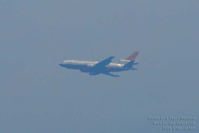
A DC-10 has been brought in to help. That is such a comfort.
6,000 acres now.
More later. I wanted to get this up in case we lose power.
***********************
Update 7:00
The mandatory evacuation area may not be all the way to Cathedral Oaks. It may still be north of Patterson. There are conflicting reports. In any case, we are ready. We did lose power for just about 5 minutes. I hate when that happens!
They've expanded the mandatory evacuation area this evening. I'm learning how to better use Google Maps, so here is what I understand is the current evacuation warning (light blue) and mandatory evacuation (dark blue) areas. You see our house at the blue bubble.
View Larger Map
It is definitely feeling more real now. And of course, the winds are yet to come, if they are to come at all.
So you can understand Sundowners better, on the Solstice day this year, at noon the temperature was about 85ºF. At about 8:00pm, it got windy, and the temperature jumped to 96 degrees. It is an unusual, and unsettling even in the best of times, phenomenon.
A DC-10 has been brought in to help. That is such a comfort.
6,000 acres now.
More later. I wanted to get this up in case we lose power.
***********************
Update 7:00
The mandatory evacuation area may not be all the way to Cathedral Oaks. It may still be north of Patterson. There are conflicting reports. In any case, we are ready. We did lose power for just about 5 minutes. I hate when that happens!
Friday Mid-day Gap Fire Update
12:00 noon
Good day!
After a few tense hours last night, we were able to settle down into sleep and had a good night's sleep, sleeping in late.
This morning we awoke to clear skies, and a few actual clouds that mixed in parts with smoke. The smoke is less dense, and no ash is falling on us this morning. Whew! Last night it was really bad. Mike and I took a short walk to see if we could see flames, and the air quality was scary it was so bad! Here is some pictures of my car this morning.


There have been no new evacuations or evacuation warnings. Whew!
Winds are calm today. Let’s hope they stay calm throughout the day and night.
Mike has to go to work at 3:00 today, to work the beach for the Independence Day celebration. Kevin still wants to go to the fireworks (he bought some light-up necklaces to sell), but Erin and I are wary. Unless things change drastically for the better, I think we'll stay home. I don't want to leave the dogs here alone.
The latest statistics are:
Acres burned: 5,400
Containment: 10%
Crews on site: 1,072
Other resources: 30 engines, 20 aircraft, 16 dozers
Injuries: 0
Structures burned: 0
Structures threatened: 1700
Cause: Man-made. Unknown if intentional or accidental.
Weather forecast: Gusts of 30mph winds N; current temp: 75; 25% humidity
Weather for Santa Barbara
************************
Update 12:45pm
We lost power again for about half an hour. I was in the middle up uploading the pictures I forgot to upload when I published my post! Sorry for the confusion.
Good day!
After a few tense hours last night, we were able to settle down into sleep and had a good night's sleep, sleeping in late.
This morning we awoke to clear skies, and a few actual clouds that mixed in parts with smoke. The smoke is less dense, and no ash is falling on us this morning. Whew! Last night it was really bad. Mike and I took a short walk to see if we could see flames, and the air quality was scary it was so bad! Here is some pictures of my car this morning.


There have been no new evacuations or evacuation warnings. Whew!
Winds are calm today. Let’s hope they stay calm throughout the day and night.
Mike has to go to work at 3:00 today, to work the beach for the Independence Day celebration. Kevin still wants to go to the fireworks (he bought some light-up necklaces to sell), but Erin and I are wary. Unless things change drastically for the better, I think we'll stay home. I don't want to leave the dogs here alone.
The latest statistics are:
Acres burned: 5,400
Containment: 10%
Crews on site: 1,072
Other resources: 30 engines, 20 aircraft, 16 dozers
Injuries: 0
Structures burned: 0
Structures threatened: 1700
Cause: Man-made. Unknown if intentional or accidental.
Weather forecast: Gusts of 30mph winds N; current temp: 75; 25% humidity
Weather for Santa Barbara
************************
Update 12:45pm
We lost power again for about half an hour. I was in the middle up uploading the pictures I forgot to upload when I published my post! Sorry for the confusion.
Thursday, July 3, 2008
Thursday Evening Gap Fire Update
9:45 pm
We lost power at about 7:15 for a couple hours. I'll tell ya, things seem worse in the dark, especially when right about the same time, they announced another mandatory evacuation, one that is pretty close.
They ordered an evacuation for North of the Patterson curve from Patterson Avenue to Fairview.
Here is where that area is. Click on the blue balloons to get a description of what I'm talking about.
View Larger Map
Needless to say, we are a little nervous. We packed up a few more things and are ready to go if needed. We're calm and being vigilant.
Reportedly, 3000 acres have burned. 1000 homes are threatened.
To answer Poss's earlier comment: Unfortunately, the rains stopped in March or so. The humidity fluctuates depending on the winds. When those sundowners happen, the air comes from the desert, so not only do we get fast dangerous winds, it is hot dry air. If the winds blow from the ocean, all is well: moist air blowing toward the backcountry. Just hope for no sundowners.
Thanks for all of your concern. Don't worry too much. We'll be fine.
We lost power at about 7:15 for a couple hours. I'll tell ya, things seem worse in the dark, especially when right about the same time, they announced another mandatory evacuation, one that is pretty close.
They ordered an evacuation for North of the Patterson curve from Patterson Avenue to Fairview.
Here is where that area is. Click on the blue balloons to get a description of what I'm talking about.
View Larger Map
Needless to say, we are a little nervous. We packed up a few more things and are ready to go if needed. We're calm and being vigilant.
Reportedly, 3000 acres have burned. 1000 homes are threatened.
To answer Poss's earlier comment: Unfortunately, the rains stopped in March or so. The humidity fluctuates depending on the winds. When those sundowners happen, the air comes from the desert, so not only do we get fast dangerous winds, it is hot dry air. If the winds blow from the ocean, all is well: moist air blowing toward the backcountry. Just hope for no sundowners.
Thanks for all of your concern. Don't worry too much. We'll be fine.
Thursday Afternoon Gap Fire Update
5:00 pm
There is a new evacuation order for West Camino Cielo west of the Highway 154 (near the start of the fire), and the evacuation "warning" area has expanded west (away from us) to Winchester Canyon. The fire has burned 2600 acres. The Governator has declared a state of emergency, and apparently our fire will take priority for the already-stretched firefighting resources in the state.
The sky is covered with thick smoke, and big honkin' ashes are falling on us. This morning when I went to my car to go to work, I noticed this ash on the door/window junction.

Here are some pictures that I took last night at about 9:30pm. These were taken from this spot looking northwest.
View Larger Map


I know they aren't the best pictures of the fire, but you can imagine how unnerving it is to see the flames just a few miles away.
They've canceled the fireworks in Goleta, but as far as I know the fireworks down at West Beach in Santa Barbara are still on.
There is a possibility of another power outage. The City of Goleta put out a reverse-911 call this morning just to inform residents of the updates. I was glad to see it works. I'm also glad I saved an old-fashioned land-line phone that is not electric, so that we may still have phone service in a power outage!
Here is a link to a map, courtesy of the Independent.
I'll keep you posted. So far, so good. Luckily, winds are staying calm, and that is the best news.
****************
UPDATE 6:40
The lights have been flickering off and on for the last few minutes. I have a feeling we're in for another dark night.
There is a new evacuation order for West Camino Cielo west of the Highway 154 (near the start of the fire), and the evacuation "warning" area has expanded west (away from us) to Winchester Canyon. The fire has burned 2600 acres. The Governator has declared a state of emergency, and apparently our fire will take priority for the already-stretched firefighting resources in the state.
The sky is covered with thick smoke, and big honkin' ashes are falling on us. This morning when I went to my car to go to work, I noticed this ash on the door/window junction.

This piece of leaf ash is about 1" across.
Here are some pictures that I took last night at about 9:30pm. These were taken from this spot looking northwest.
View Larger Map


I know they aren't the best pictures of the fire, but you can imagine how unnerving it is to see the flames just a few miles away.
They've canceled the fireworks in Goleta, but as far as I know the fireworks down at West Beach in Santa Barbara are still on.
There is a possibility of another power outage. The City of Goleta put out a reverse-911 call this morning just to inform residents of the updates. I was glad to see it works. I'm also glad I saved an old-fashioned land-line phone that is not electric, so that we may still have phone service in a power outage!
Here is a link to a map, courtesy of the Independent.
I'll keep you posted. So far, so good. Luckily, winds are staying calm, and that is the best news.
****************
UPDATE 6:40
The lights have been flickering off and on for the last few minutes. I have a feeling we're in for another dark night.
Thursday Morning Gap Fire Update
7:50am
I had planned to update you last night, but at about 7:15, we lost power. It was restored by 11:30pm. The power outage affected the whole area, from Carpinteria to Goleta.
Erin and I sat by candlelight and worked, wrote and read. Kevin went to his friend's house to play poker in the dark. Poor Kibble was terrified and trembling all evening. She is afraid of light, as you recall. The candles frightened her. She was glued to my side and insisted that I keep my hand on her.
Reports are that mild sundowners did increase the fire to 1900 acres. It is said to be 5% contained. No new evacuations have been ordered. I took some pictures from our neighborhood last night. Later today, I'll see if any are worth posting.
Classes were canceled today again. I hope they'll be in session again by Monday.
More later.
Links to Fire Info:
InciWeb
Santa Barbara Independent
KEYT News
I had planned to update you last night, but at about 7:15, we lost power. It was restored by 11:30pm. The power outage affected the whole area, from Carpinteria to Goleta.
Erin and I sat by candlelight and worked, wrote and read. Kevin went to his friend's house to play poker in the dark. Poor Kibble was terrified and trembling all evening. She is afraid of light, as you recall. The candles frightened her. She was glued to my side and insisted that I keep my hand on her.
Reports are that mild sundowners did increase the fire to 1900 acres. It is said to be 5% contained. No new evacuations have been ordered. I took some pictures from our neighborhood last night. Later today, I'll see if any are worth posting.
Classes were canceled today again. I hope they'll be in session again by Monday.
More later.
Links to Fire Info:
InciWeb
Santa Barbara Independent
KEYT News
Wednesday, July 2, 2008
Wednesday Afternoon Gap Fire Update
3:30pm


I took these pictures this afternoon at about 1:00pm from this spot. The photo is looking north.
View Larger Map
Not much has changed. 300 acres as of 2:00pm. Lots of helicopters flying around. They are saying 5% contained. Still no cause identified. There was a press conference at 2:00pm. Here is the video from the news.
There have been a few ashes floating around, and the light definitely looks "strange" outside. Otherwise, all is well right now. If the winds don't start up, we're fine. If the sundowners kick in, it will be unpredictable.
I've got photos and important papers packed in the trunk.
Watch this space.


I took these pictures this afternoon at about 1:00pm from this spot. The photo is looking north.
View Larger Map
Not much has changed. 300 acres as of 2:00pm. Lots of helicopters flying around. They are saying 5% contained. Still no cause identified. There was a press conference at 2:00pm. Here is the video from the news.
There have been a few ashes floating around, and the light definitely looks "strange" outside. Otherwise, all is well right now. If the winds don't start up, we're fine. If the sundowners kick in, it will be unpredictable.
I've got photos and important papers packed in the trunk.
Watch this space.
Wednesday Morning Gap Fire Update
7:00 am
They are calling it the "Gap Fire."
The only news is that summer school classes at Dos Pueblos High School have been cancelled as the school is being used as a command center for the fire fighting effort. Erin: "YES!"
I smelled smoke finally when I woke up. I hear aircraft up there. The weather is bright and sunny but there is no wind. As of now, the fire is about 200 acres. Flames 15-20 feet high. It is in rugged, steep terrain. The cause is said to be human-caused, but no other information.
We're hanging tight.
This is a better link for news. You can see picutres from a link there.
They are calling it the "Gap Fire."
The only news is that summer school classes at Dos Pueblos High School have been cancelled as the school is being used as a command center for the fire fighting effort. Erin: "YES!"
I smelled smoke finally when I woke up. I hear aircraft up there. The weather is bright and sunny but there is no wind. As of now, the fire is about 200 acres. Flames 15-20 feet high. It is in rugged, steep terrain. The cause is said to be human-caused, but no other information.
We're hanging tight.
This is a better link for news. You can see picutres from a link there.
Tuesday, July 1, 2008
Fire News
There is a fire burning up in the mountains just north of us. It is a couple miles northeast of "A" from what I can understand. Our house is near "B."
View Larger Map
They are not calling for evacuations, just to be on alert and watch the TV. I'm getting a few things together, but I'm not worried.
No structures threatened at this time. The weather looks cooperative so far. No real winds. It is almost 18 years to the day of the Painted Cave Fire.
I'll keep you updated.
*********************************
Update 10:20pm.
Mandatory evacuations for Glen Annie Canyon and La Patera Canyon. Those are the canyons to the north of Glen Annie Road and La Patera Road north of Cathedral Oaks.
There is an evacuation "warning" for the areas between Fairview and Glen Annie north of Cathedral Oaks Road.
I've got photos and important papers packed. Now, I'm going to pack a small suitcase. I seriously doubt anything will happen to us.
Watch this space.
*******************************
Update 11:30pm
The weather continues to cooperate. Winds are calm. Air tankers will resume in the daylight. There are no changes in evacuation orders or in the general nature of the fire. The TV news has signed off to regular programming. I'll update again in the morning. I'm going to bed.
View Larger Map
They are not calling for evacuations, just to be on alert and watch the TV. I'm getting a few things together, but I'm not worried.
No structures threatened at this time. The weather looks cooperative so far. No real winds. It is almost 18 years to the day of the Painted Cave Fire.
I'll keep you updated.
*********************************
Update 10:20pm.
Mandatory evacuations for Glen Annie Canyon and La Patera Canyon. Those are the canyons to the north of Glen Annie Road and La Patera Road north of Cathedral Oaks.
There is an evacuation "warning" for the areas between Fairview and Glen Annie north of Cathedral Oaks Road.
I've got photos and important papers packed. Now, I'm going to pack a small suitcase. I seriously doubt anything will happen to us.
Watch this space.
*******************************
Update 11:30pm
The weather continues to cooperate. Winds are calm. Air tankers will resume in the daylight. There are no changes in evacuation orders or in the general nature of the fire. The TV news has signed off to regular programming. I'll update again in the morning. I'm going to bed.
Subscribe to:
Posts (Atom)